
Big Bend National Park, TX - Santa Elena Canyon
- Alexandra Proctor
- Jun 5
- 2 min read

State - Texas
Trailhead Location: https://maps.app.goo.gl/TndKNXbAJoYBGx51A
Trailhead Access: Old Maverick Road (unpaved) or Ross Maxwell Scenic Drive (Paved)
Park: Big Bend National Park
Length: 1.7 miles
Fee: $30 entrance fee per private vehicle (no cash accepted). Annual passes are free.

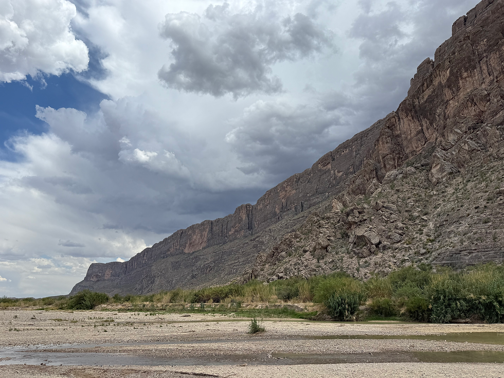
The cliffs of Santa Elena Canyon slowly rise in the distance, as the 4runner advances and crunches over gravel and sand on Ore Mine Road. The temps have risen steadily to 108F. Even with the windows rolled down, the breeze isn't a balm to the scorching desert that drifts by the road. The wind is hot, languid, and slow. Not a cloud fills the sky or offers the reprieve of shade to a desert dweller or hiker.
I roll past a neon alert sign stranded on the side of the road, warning passing cars to "Be off trail by noon," due to dangerous temperatures. I glance at my watch. It's 1pm and the horizon in front of me is swirling, curling, and melting the far canyons and rock into a distorted mirage. This landscape isn't kind or friendly. It's a place of pure survival. And despite the fact that I'm well hydrated and encapsulated within the false refuge of an air-conditioned vehicle, this place remains eerie.
I reach the trailhead, a modest parking lot with facilities, and park. Stepping out of the 4Runner is like getting hit by a grill's heat wave. I wince and start to grab my gear and fluids. As much as I love this trail, I want to minimize my exposure time before hitting the river. A hiker can become disoriented quickly in these temperatures, especially if they underestimate the gravity of heat exhaustion symptoms.

After a brief walk from the trailhead, the waters of the Rio Grande come into view. At today's hike, the water flowed free and green, the color primarily derived from suspended limestone particles reflecting light and the presence of planktonic and blue-green algae.
The trickiest part of the trek is crossing Terlingua Creek to reach the remaining portion of the trail that snakes into Santa Elena Canyon. If there have been recent rains or if storms are in the forecast, be aware of water levels. Far off thunderstorms and rainfall can cause the creek to rise quickly. I wouldn't want to be caught on the other side of the creek in the canyon under those circumstances.
Once across the creek, keep following the trail as it rises along the bluffs and then falls back down into the canyon alongside the Rio.
Make sure to take a quick dip in the Rio. But watch your step as the mud along the riverside is slippery. Once you've relaxed in the river, head back the way you came.

Follow the map below to find the creek crossing. This trail did not take me into Mexico, as it seems! It was simply an error of the GPS under SOS conditions!
--Happy Hiking!


Comments